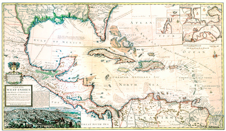
Mapa del Caribe de 1715
Mapa del Caribe de 1715
Precio habitual
$22.95 USD
Precio habitual
Precio de oferta
$22.95 USD
Precio unitario
/
por
Los gastos de envío se calculan en la pantalla de pago.
Retiro disponible en 523 Saint Ann Street
Normalmente está listo en 24 horas
El mapa grande y atractivo de Herman Moll muestra el Caribe en 1715, el Golfo de México y el continente y las islas circundantes con gran detalle. Varios mapas de puertos insertados y una hermosa vista de la Ciudad de México se suman a la belleza y el interés de este grabado distintivo.
- Tamaño: 15 1/4 x 26 1/2 pulgadas
- De colores
- Papel con gramaje de texto
- Encerrado en tubo para mayor seguridad del producto.